
Walking & the Coast Path
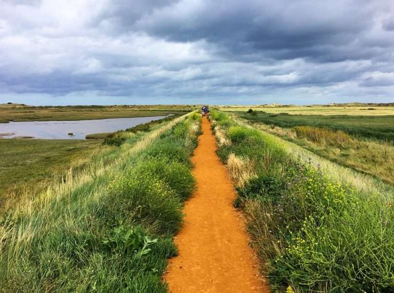
Brancaster Staithe sits on the Norfolk Coast Path, roughly halfway between Hunstanton and Wells-next-the-Sea. Step out of either apartment, and you are on the path within two minutes. That alone makes it a good base for walking this stretch of coast — but there is more to it than the long-distance route.
The Norfolk Coast Path
The Norfolk Coast Path runs for 84 miles from Hunstanton to Hopton-on-Sea. The section that matters for a stay here is the western half Thornham to Wells —which passes through some of the least developed coastline in England. The full
Thornham-to-Wells stretch is about 15 miles, but you do not need to walk it in one go. The Coasthopper bus runs along the coast road and stops at every village, so you can walk one way and catch the bus back; or take the bus and walk back.
West from Brancaster Staithe, the path crosses the marshes towards Brancaster and then on to Thornham taking a tack inland. — flat, open walking with wide views across the salt marsh to the sea. The stretch between Brancaster Staithe and Thornham is roughly five miles each way, manageable as a half-day walk with the bus return.
East from here, the path follows the sea wall from the harbour towards Burnham Deepdale, then continues through Burnham Overy Staithe to Gun Hill along Holkham beach and on to Wells. This is the more varied direction — the dunes at Holkham open up after the tighter marsh paths, and the pine woods behind the beach are unlike anything else on this coast. Brancaster Staithe to Wells is about eight miles, a full day if you take it at a comfortable pace with stops. The Hero at Burnham Overy Staithe is a good spot for lunch.
Walks from the Doorstep
Not every walk needs to be a route march. Some of the best walking here is short and close.
Barrow Common, directly behind the village, simply turn right onto Common Lane from the apartments and you can’t go wrong. It is a mix of heath, scrub, and open grassland with views north across the marshes and out to Scolt Head Island. In spring, the gorse is yellow, the turtle doves purr and skylarks are overhead. In autumn, the common is quieter and the light across the marsh changes by the hour. A circular walk around the common takes 40 minutes to an hour depending on how often you stop.
The harbour path takes you from the Staithe harbour towards Scolt Head Island where you will pass oyster beds, mussel beds and cockle beds. At low tide you can wade across to the island — but check the tide times carefully before attempting this,as the creek fills quickly on the turn. There is a ferry from Burnham Overy Staithe if you prefer not to wade or you get stuck having done so.
For a longer local circuit, walk east along the coast path from Burnham Deepdale, turn inland through Burnham Norton, and loop back to Brancaster Staithe via the road or the field paths. This takes about two hours and gives you the contrast between the open marsh and the sheltered farmland behind it.
Practical Notes
The coast path here is largely flat. There are no significant climbs. Underfoot conditions vary — boardwalks and gravel in some sections, muddy field edges and uneven marsh paths in others. Waterproof boots are worth having in winter or wet conditions.
The Coasthopper bus (service 36) is the walker's best friend on this coast. It runs between Hunstanton and Wells, stopping at every village along the way, and runs frequently enough iseason that you can plan a linear walk without worrying about the return leg. Timetables are available at the bus stops and online.
Tides matter. Several unmarked paths along the marsh edge become impassable at high water, and the crossing to Scolt Head is only possible around low tide. Check tide times before setting out —they are linked in our Area Guide and published on the Royal West Norfolk Golf Club website.
For more detail on seasonal walking conditions and what to look out for month by month, see our Year on the North Norfolk Coast page.